
.svg)
3D laser scanning & mockups
.png)
What defines
us
.svg)
.svg)
.svg)

.png)
Case Study anfordern

FAQ
The process begins with on-site scanning, during which the point clouds are captured and pre-registered directly in the app. Quality assurance is then carried out by carefully checking the captured data.In the subsequent post-processing in our company, the point clouds are imported, the registration is optimised and aligned, cropped and edited with filters to hide unnecessary areas. The optimised data is then published and made available in your desired format.
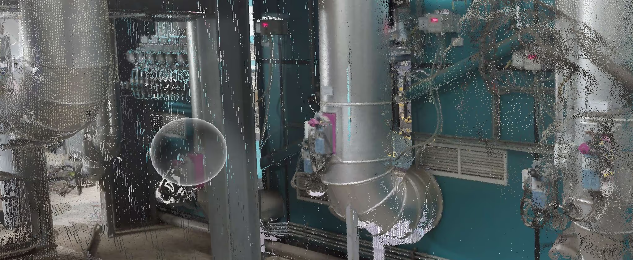
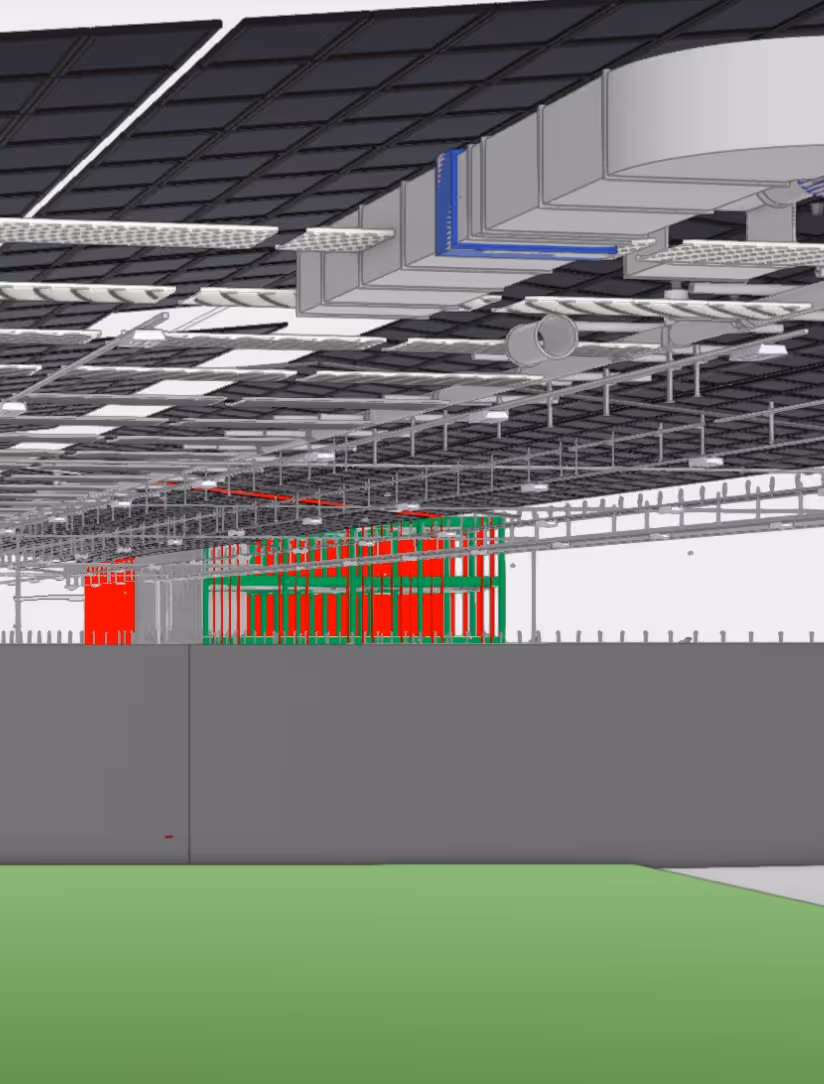
3D laser scanning enables precise and complete recording of your existing system or building. This provides you with an exact digital model as a basis for planning, conversions or extensions. Advantages:
- Time savings thanks to accurate as-built surveys without time-consuming on-site measurements
- Reduction of planning errors thanks to data accurate to the millimetre
- Efficient clash detection as early as the planning phase
- Optimum interface to BIM processes for end-to-end digital workflows
Thanks to millimetre-precise recording, you save time and avoid planning errors.
We provide the digital twin of your system in various formats, depending on your requirements. You can receive the pure point cloud or a post-processing that is customised to your needs. Common exchange formats are Autodesk ReCap (*.RCP) as well as industry-standard formats such as *.E57, *.PTX, *.PTG, *.PTS or *.LAS. The exchange into various CAD systems is also possible. Contact us for a personalised consultation.
A scan point consists of up to 65 million laser points. At a distance of 10 metres from the object, the accuracy is around 5 mm. The accuracy can be increased by scanning closer to the object or by capturing additional scan points (locations). This allows us to achieve a resolution of less than 1 mm if required.
3D laser scanning is worthwhile wherever precise digital recording of existing plants or buildings is required. Typical areas of application in plant construction are:
- As-built surveys before conversions or extensions
- Recording of complex pipework and steel structures
- Documentation of areas that are difficult to access or safety-critical
- Surveying for the replacement of machines or plant components
- Quality control after construction or assembly progress
Fast and seamless recording saves you time, reduces measurement errors and optimises planning processes.
%20(1).png)
Do you have
any further questions?
Do you have any questions about our products or would you like a personal consultation? Contact us — we'll be happy to help.
Customer reviews

Further
offers
.avif)
We are looking forward to your message
Do you have any questions about our products or would you like a personal consultation? Contact us — we'll be happy to help.
.avif)
Buchmattstrasse 9
3400 Burgdorf
Schweiz


Would you like to learn more about Friedli AG? Our company presentation offers you exciting insights and in-depth information.